| This is a copy -
'StringyBark Creek Interpretive Strategy' for 'Stringybark
Creek Historic Reserve Project' Update 2017 as issued to interested
stakeholders or anyone wishing to make a comment. Please read all the
pages and if you have an opinion I'm sure the authorities will be
interested in your comment. This draft page
which can be accessed via this 'Dropbox URL link here below was
prepared by
Charles Walsh Nature Tourism https://www.dropbox.com/s/043ti5j128e7woc/Stringybark%20creek%20draft%20interpretation%20strategy%20-%2028%3A8%3A2017.pdf?dl=0 |
|
Comments: Bill Denheld |
With compliments to
Charles Walsh Nature Tourism
who has created an interesting graphic proposal. |
|
From Dee Caruthers - see
Blog Bill |
My
question relates to the very first sentence of the very first sign that
visitors will read on the ‘Entry panel’ : “Welcome to the
Stringybark Creek Historic Reserve – home to one of Australia’s most
researched and analysed crime scenes” |
| Comments for above - Bill Denheld | Not all pages are represented in this commentary,
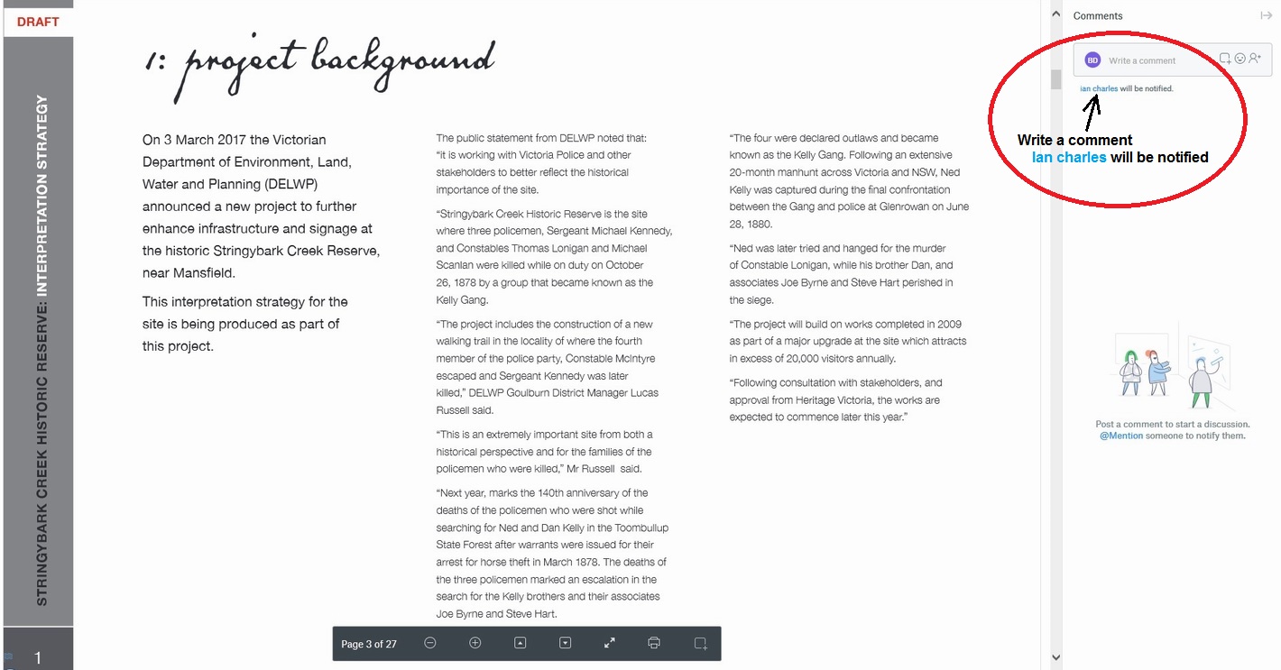
only pages relevant to SBC. Below is the original Dropbox link- Be aware this is a large download -DRAFT STRATEGY (37MB) https://www.dropbox.com/s/043ti5j128e7woc/Stringybark%20creek%20draft%20interpretation%20strategy%20-%2028%3A8%3A2017.pdf?dl=0 Once fully opened, you will notice there is a comment box on the right panel as shown in image No 1: Project Background - below circled in red. Alternatively please make comment on the Message Forum at the bottom of this webpage. |
|
Comments for 1:
Bill
|
Please note: In the above 'Project Background' first paragraph, "The public Statement
from DELWP noted that: "it is working with Victoria Police
and other stakeholders to better reflect the historical importance of
the site" So its clear the Victorian Police are behind this proposed upgrade and have briefed DELWP and Heritage Victoria accordingly. It is interesting to note, where in the third paragraph, it clearly states a walking trail will follow the tracks of Const McIntyre and where Srgnt Kennedy was later killed? This is what we want, but these proposed plans have the Kennedy site on the wrong side of the SBC road and west of the creek where, as primary source material tells us, was to the North East of SBC. In recent news media, DELWP District manager Lucas Russell said about the trail "this is extremely important from both a historical perspective and for the families of the policemen who were killed" We all agree, but that is not what is proposed here. So lets make sure any trails and signage to be placed are directed as near to the correct site as possible.
Previously the SBC history tourist and police
descendants visiting these parts have been led up the garden path, and every
effort must be taken this does not happen again. If you have an opinion
please read all the pages and contact DELWP or this page message forum
way below. |
|
Comments for 3:
V.P.H.U.
Heritage Victoria
|
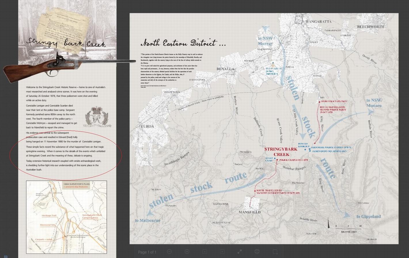
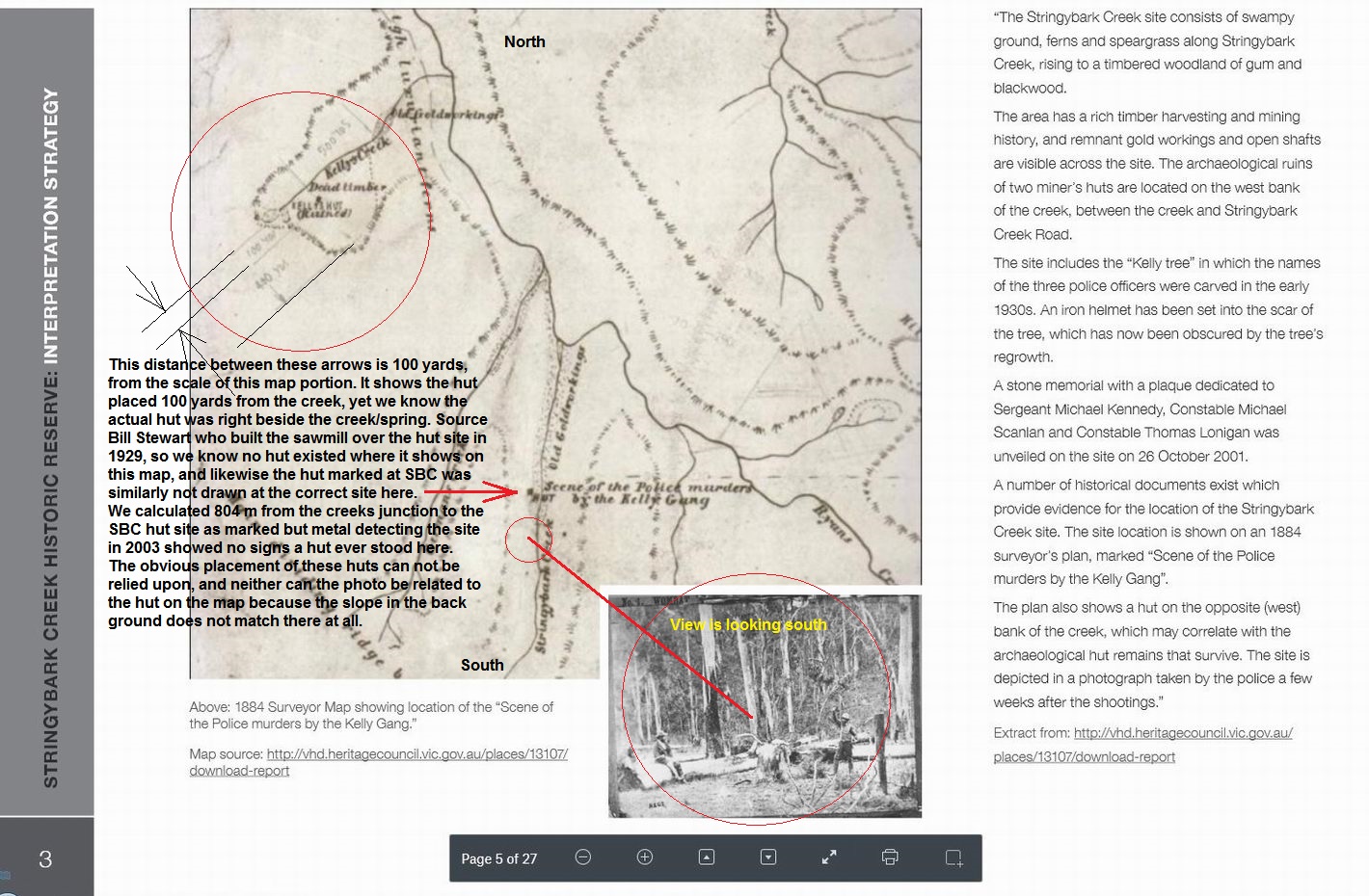
This particular map above came from one of my early WebPages. I know its
my scan from a Kelly history picture book because I drew the faint pencil lines
according to scale, and for when I nominated the whole area for Heritage listing as
nobody had bothered to do so. I wrote the submission and several years
later it was accepted on the heritage register. I was the informant and nominee. The
point I will make is that while everyone who has studied my documents
past and present, will know that the hut on this particular 1884 map relating to the Police camp
was not actually marked on the map where it should have been. In fact the true place
is more than 200 metres to the south near the end of the red line page
3, as where the Burman photo was taken.
There are the remains of two huts there. So why has this information not
been acknowledged for use by Ian Charles ? Fact, Constable Lonigan
was shot dead between the seated man and the central stump according to
McIntyre who made a drawing and led a party back to the scene. |
|
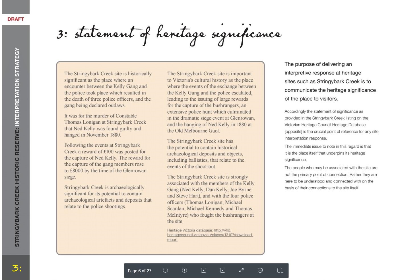
Comments for above 3:
Bill |
There is no longer any doubt or mystery about where these sites are, and as in the above texts by Ian Charles, see item 3, "The immediate issue to note in this regard is that it is the place itself that underpins its heritage significance." If this is so, then this is not being addressed at all within this proposed interpretive strategy text. I knew the significance of this when in 2004 I nominated the whole of Stringybark Ck including Kelly camp sites to Heritage Victoria, and wrote the 'statement of Heritage Significance in my submission, and four years later was promised by Heritage Vic archaeology head, Mr Jeremy Smith that archaeology would be undertaken at SBC to prove the sites. To my knowledge this has never happened or been on any serious agenda. |
|
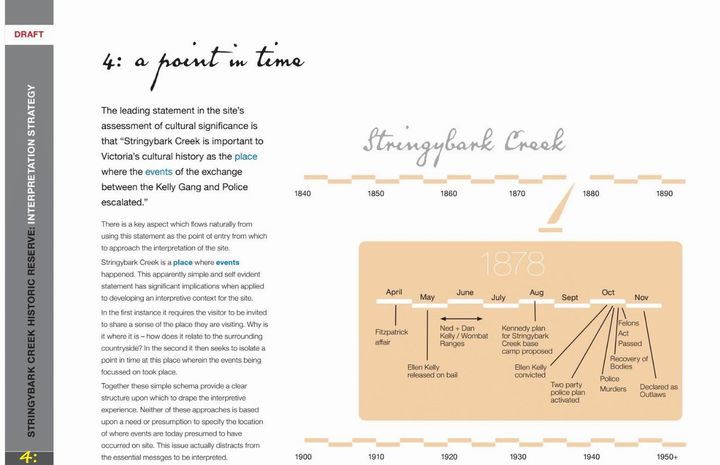
Comments for 4: Bill Denheld
Input from an interested reader -
|
"
StringyBark Creek is the place where events
happened", yes but SBC gully is more than 2 km long. " What other historical place in the entire world tries to say the exact spot is not that important - we have marked the exact place where the first fleet landed, where Gough Whitlam made his famous speech, where Melbourne was founded, where JFK was shot ( there's an X painted and repainted on the road in Dallas ..) we know exactly where the Broad Arrow cafe was at Port Arthur Tasmania, where ANZAC cove is, where the Glenrowan Inn was, where Harry Lasseter's body was found, where Bourke and Wills 'dig tree camp was, where Bourke died etc.. |
|
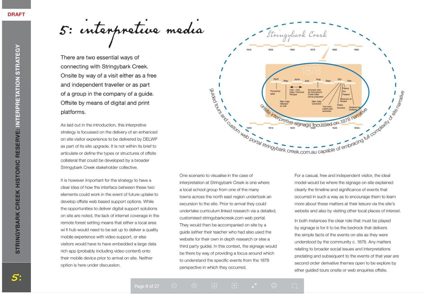
Comments for 5: Bill
Lake Mungo
|
Speaking with Ian Charles by phone, he said he
was not briefed by anyone and his commission was a clear DREAM brief,
yet in his text he says- |
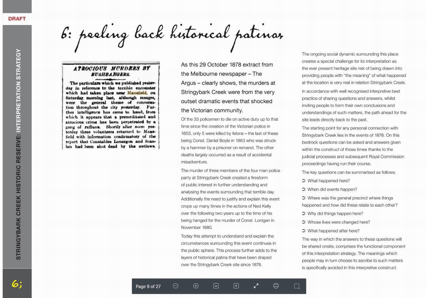
| Comments for 6: Bill | This is another page where the real questions are
avoided. "What happened here and when ? BUT no WHERE ! I suggest don't worry about peeling back the Historical Patinas, try peeling back the wool being draped over visitors eyes. |
|
Peter FitzSimons
|
"Kelly
experts can be flat out agreeing it is Tuesday, let alone having a
consensus on where precisely the Stringybark Creek is- but, in my search
for accuracy, I have been every bit as exhausted as I have been
exhausted by it. And, for the record, having visited Stringybark Creek
with Bill Denheld and seen the evidence with my own eyes, I am confident
that he has it right." |
|
Comments for 7:
Bill
|
Third Para, |
|
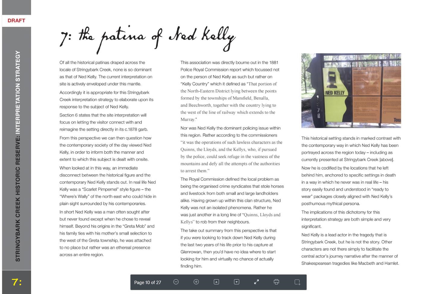
Comments for 7: Ian McFarlane, Author, The Kelly Gang Unmasked Oxford University Press, 2012
|
Stringybark Creek already has been ruined by walkways and signage that led nowhere. Now it is going to be wrecked further by a forest of new signs, and possibly entry charges. The proposed signage is mostly irrelevant waffle that includes strange concepts like 'the patina of Ned Kelly' who was a "Scarlett Pimpernel" style figure - the "Where's Wally" of the north east! There are many words, phrases and concepts that are utterly incomprehensible. Some of the arguments are so muddled they make no sense at all. Future visitors to the SBC site will need to bring a dictionary, a thesaurus and internet access to understand this signage. They will be enraged by the excessive signs, further despoiling the place. The whole experience will leave them disgusted rather than enlightened. What is needed at Stringybark Creek is the very barest of intrusive signs. A solid stone monument honouring the police murdered there would be a good start. There has been vandalism at this site before... Part of SBC's great ambience was its wilderness, now destroyed by DELWP's toilet, parking and picnic areas - and now this proposed signage wonderland. A sign
pointing to Bill Denheld's Two Huts site of the police camp/murders
should be erected once archaeology has been done. This is a very
obvious, urgent necessity! |
|
Comments for 8: Bill
|
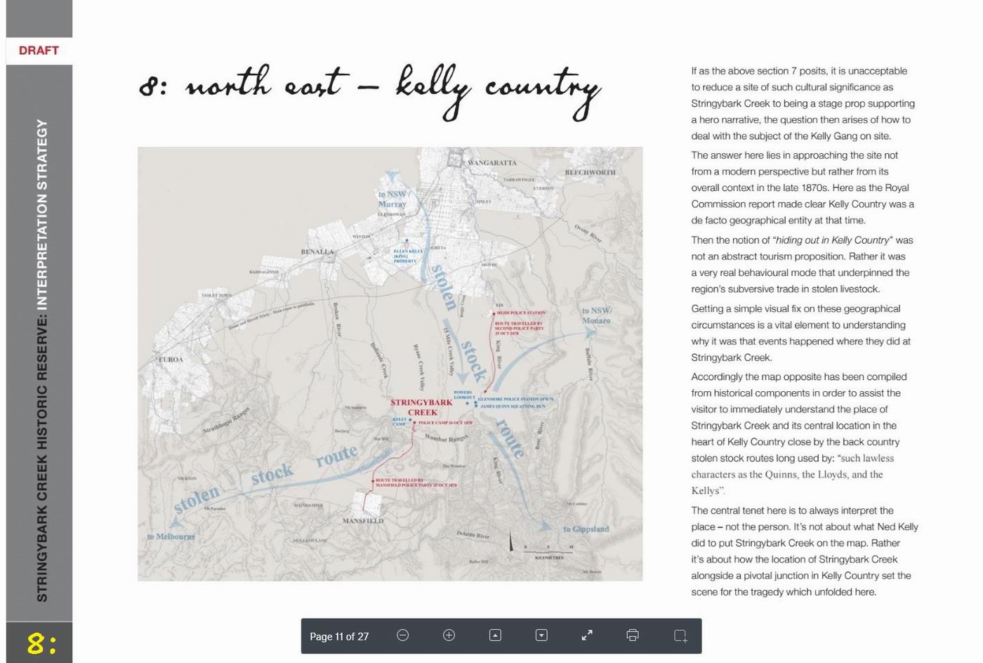
The visitor to SBC does not need to be re educated about where stolen stock were distributed to and from. He / she is there because they have read the many commentaries and now wants to see the sites at SBC where it all happened, and not be forced to stand around reading reams of text. This place can be bitterly cold, wet and miserable, I know. The history visitor has already read the whole story. All he, his wife and kids want to see is where it happened, not some extraneous explanation of where SBC is located, they already know that. If they make it there they have either come from Mansfield or Benalla, the road is twisty and in the wet 'dangerous'. They want in the shortest time to see with their own eyes what and where it happened, they don't need to read the 1881 Royal Commission, or where stolen stock were traded. We could expand on stolen stock if we were at Bullock Creek where there is a small valley that it is said stolen stock was held. |
|
Comments for 9: Bill
|
Its important this place is given over to the
police side of the story. It has little to do telling otherwise.
AND unless the 'actual sites' are
recognised and dealt with, this WHOLE exercise is a failure. |
|
Comments for12:
Bill
|
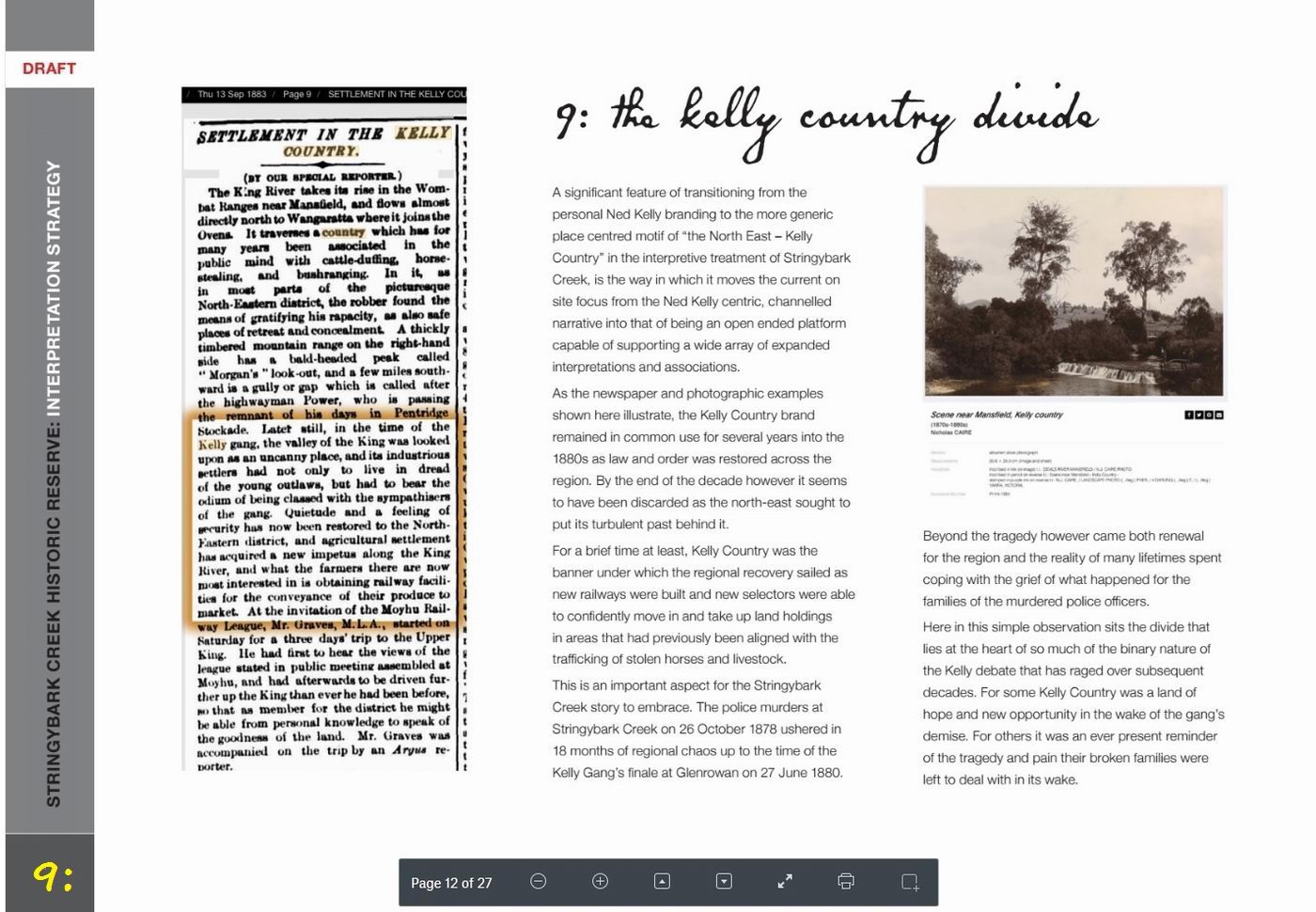
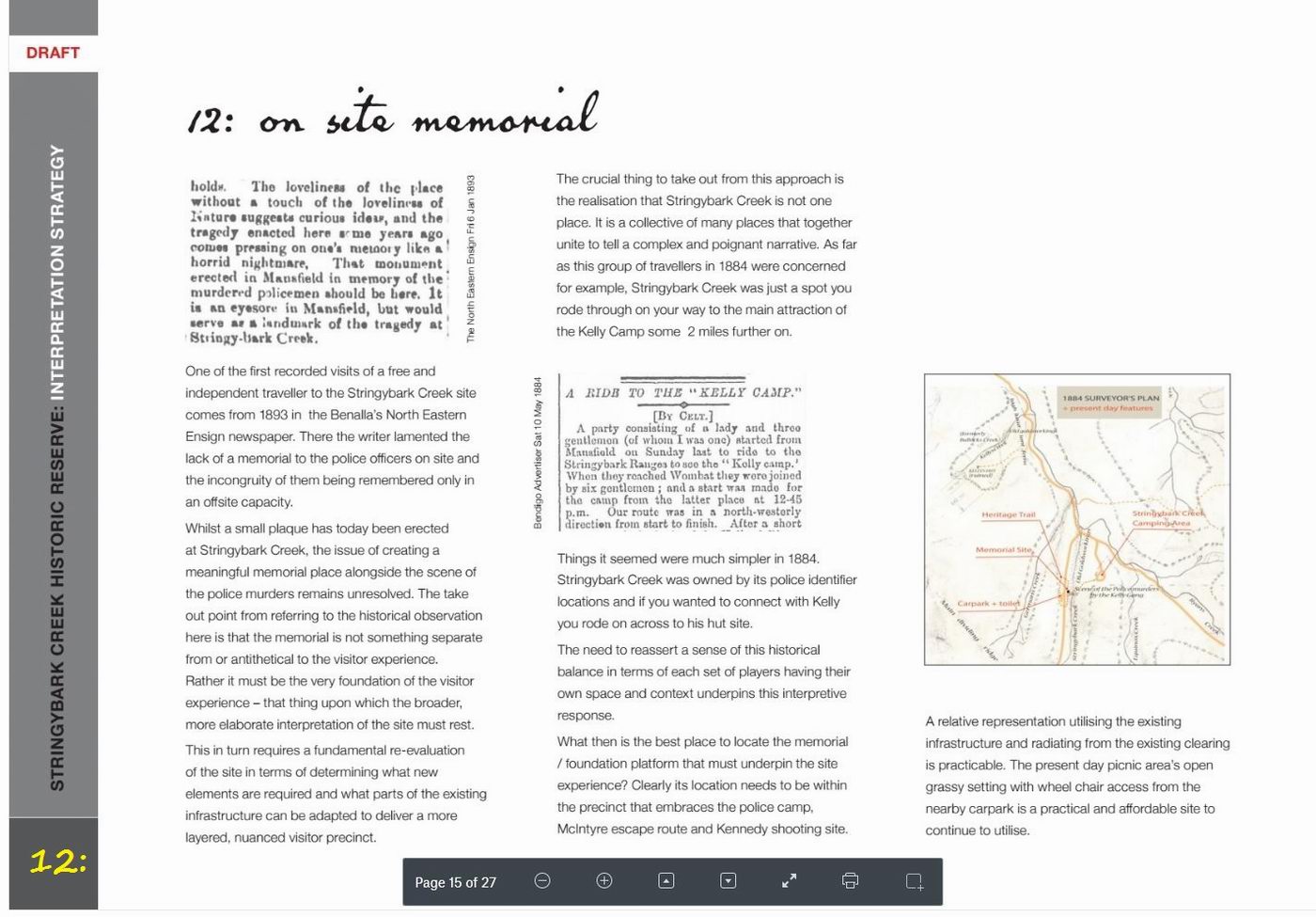
Its interesting that Ian Charles quotes a snippet from an account from
the 1884 Bendigo Advertiser 1884, some six years after the event at SBC.
The pertinent point is this, in 1884, the writer states that the police Mansfield monument should be
at SBC, yet even now there is no attempt to get it right 133 years later.
(ref 1884) The Mansfield monument to the police is one thing, if
there was to be a monument at SBC, then lets make sure its in the right place,
otherwise why spend thousands on the wrong place as noted. Ian
Charles writes (Para 6) " What then is the best place to locate the memorial / foundation
platform that must UNDERPIN the site experience? Clearly its location
needs to be within the precinct that embraces the police camp."
|
|
Comments for 13:
Bill
|
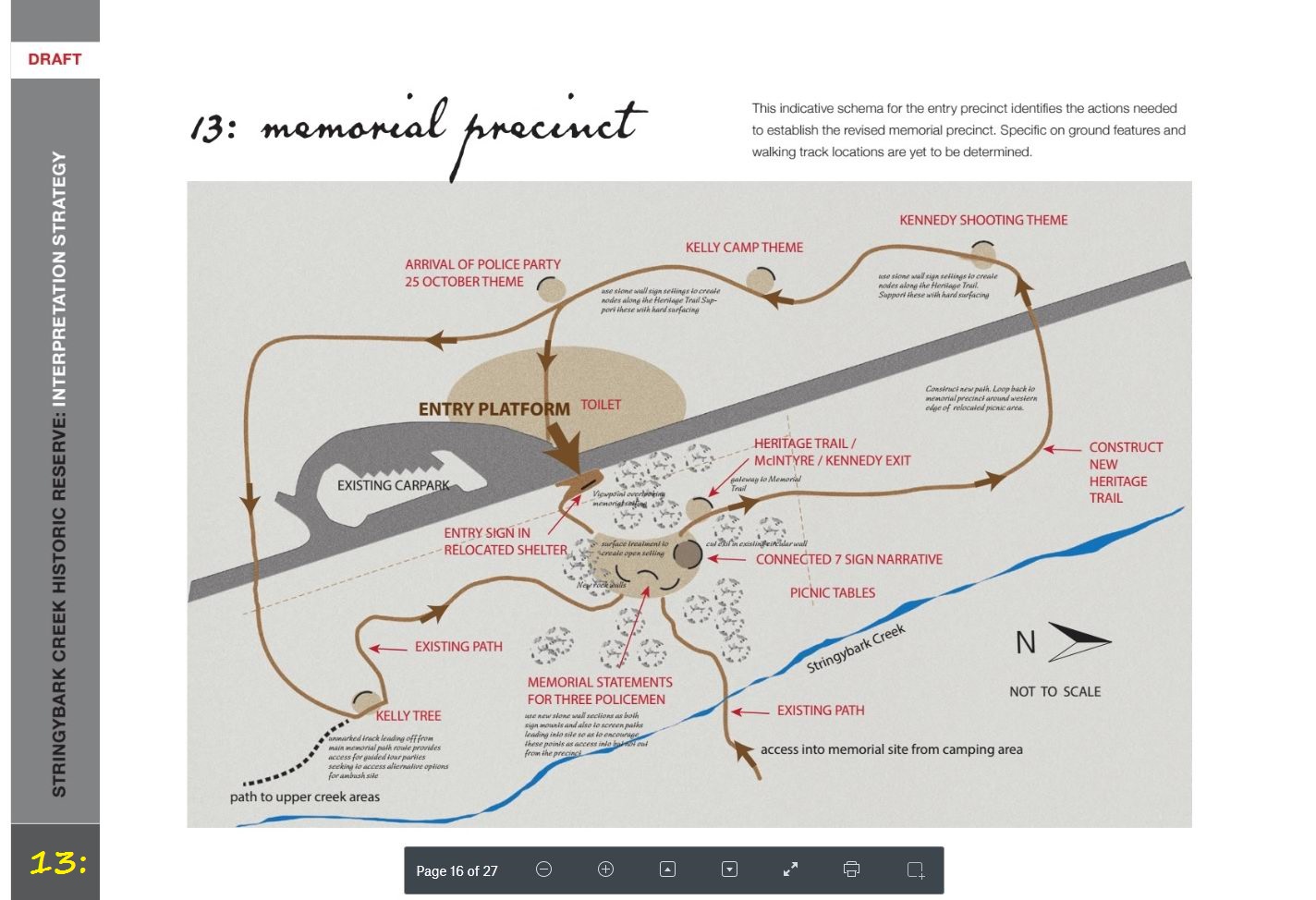
The above diagram page 'Memorial Precincts' is a joke. Firstly the
Police camp and Kennedy sites are totally in the wrong place. They are both east side of the
road, not west at all. No one coming to SBC will want to walk
around a trail that won't go to the actual sites. This will be made
clear on webpages like this, and few visitors
will be fooled. |

|
Comments for 13:
Stuart Dawson |
The
contrast between Bill's SBC map on the left hand side and the
accompanying right-hand map of the proposed trail, together with his
explanations on that and the other slides, show clearly why Bill's
points are vital to telling the story of SBC, and after reading his
comments I urge that they be implemented. Knowing the actual locations
where things happened is the whole point of going there, not to wander
around aimlessly in the general area, or you might just as well be in
some bit of stringybark forest in Gippsland. |
|
References to 18
|
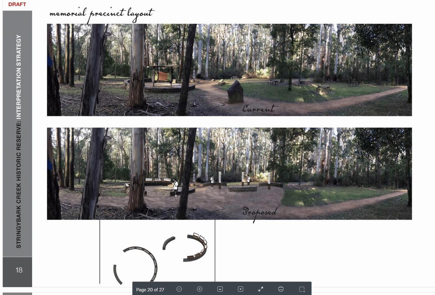
What would be achieved with the above proposed
signage
updates at the picnic ground with existing picnic tables removed so very
limited facilities would exist at SBC for coffee tea or lunch,a rest after a long
twisty drive. Below: This is the site that fits every detail of the
Burman photos and without any doubt where the police had camped. This is where the dedicated monuments
to the police
should be placed. This site could easily be reached via the existing
east bank track from the Jones site via a walk way across the creek. 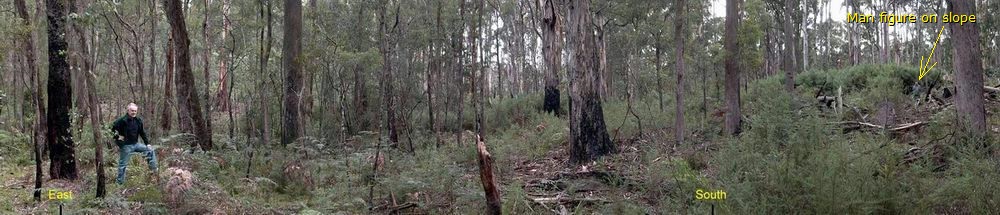 Figure standing with one foot on fireplace rocks of hut 2. The slope rises to the south where a man stands to add scale to the place. Notice all the dead trees on the slope that were dumped there by DSE which have by now rotted. This picture roughly follows the red line in the image below. The Argus 28 Oct 1878 ' the police camped from Friday evening at Stringybark on an open space on a creek - the site of some old diggings - and they pitched the tent near the ruins of two huts'. McIntyre Manuscript: the "tent was pitched a few yards behind "an old hut" and faced east. Below: The site of two huts is a tranquil open place where people could pay homage and reflect on the tragedy knowing this was the place where Const Lonigan and Scanlan were shot. If this place were archaeological and forensics investigated as it deserves to be, then the picnic ground could /should be left as it is because nothing ever happened there. 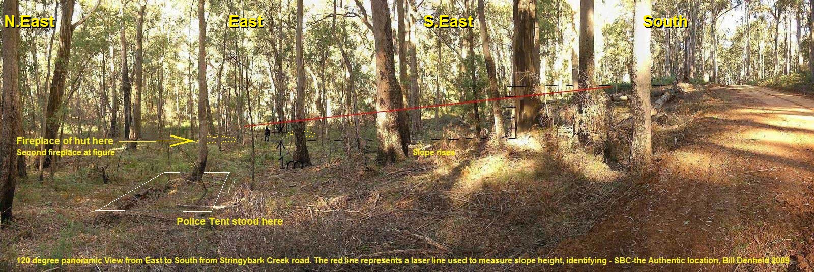 Above: The new road has been cut across the 'slope which curves to the creek S, East'. A newspaper reporter for the Herald 5 November 1878 wrote- "At the top of the slope (little hill) and overlooking the police tent, was a clump of scrub and sword grass - " Note he said 'overlooking the police tent' meant he was able to look down on the tent from above. This is important as there's no other place along SBC where you could describe the scene as to be looking down on the tent that way, so he must have stood somewhere near the top of this slope, near the end of that re line and looking down northerly from the south. Please Note: The slope was severally messed up in 2009 when the DSE decided to bulldoze all the dead trees from the top of the slope down hill and destroying the natural ambiance and appearance of the slope ( picture below). This was a disgrace as the DSE managers knew this slope was to be part of the archaeology that Jeremy Smith and Heritage Victoria had committed to investigate in May 2008. See http://www.denheldid.com/twohuts/images/twohutsfromroadlevelground.jpg |
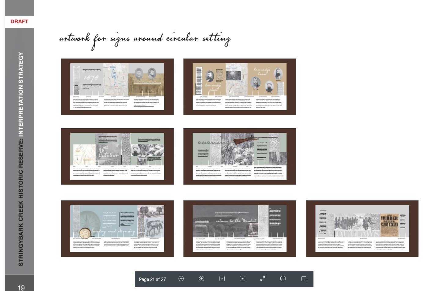
| Comments for 19: | 7 SIGN NARRATIVE
LAYOUT (35MB) https://www.dropbox.com/s/kb3aredoqd3gr91/7%20sign%20narrative%20layout-print%20out%20.pdf?dl=0 |
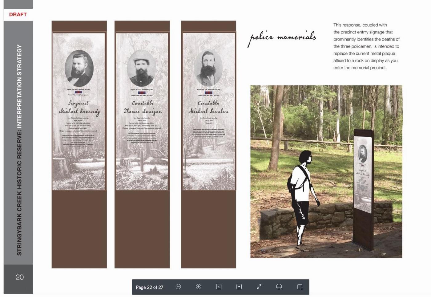
| Comments for 20: | THREE MEMORIAL
PLINTHS (4.7MB) https://www.dropbox.com/s/g741tj588yk31g7/memorial%20plinths%20-%20print%20out.pdf?dl=0 |
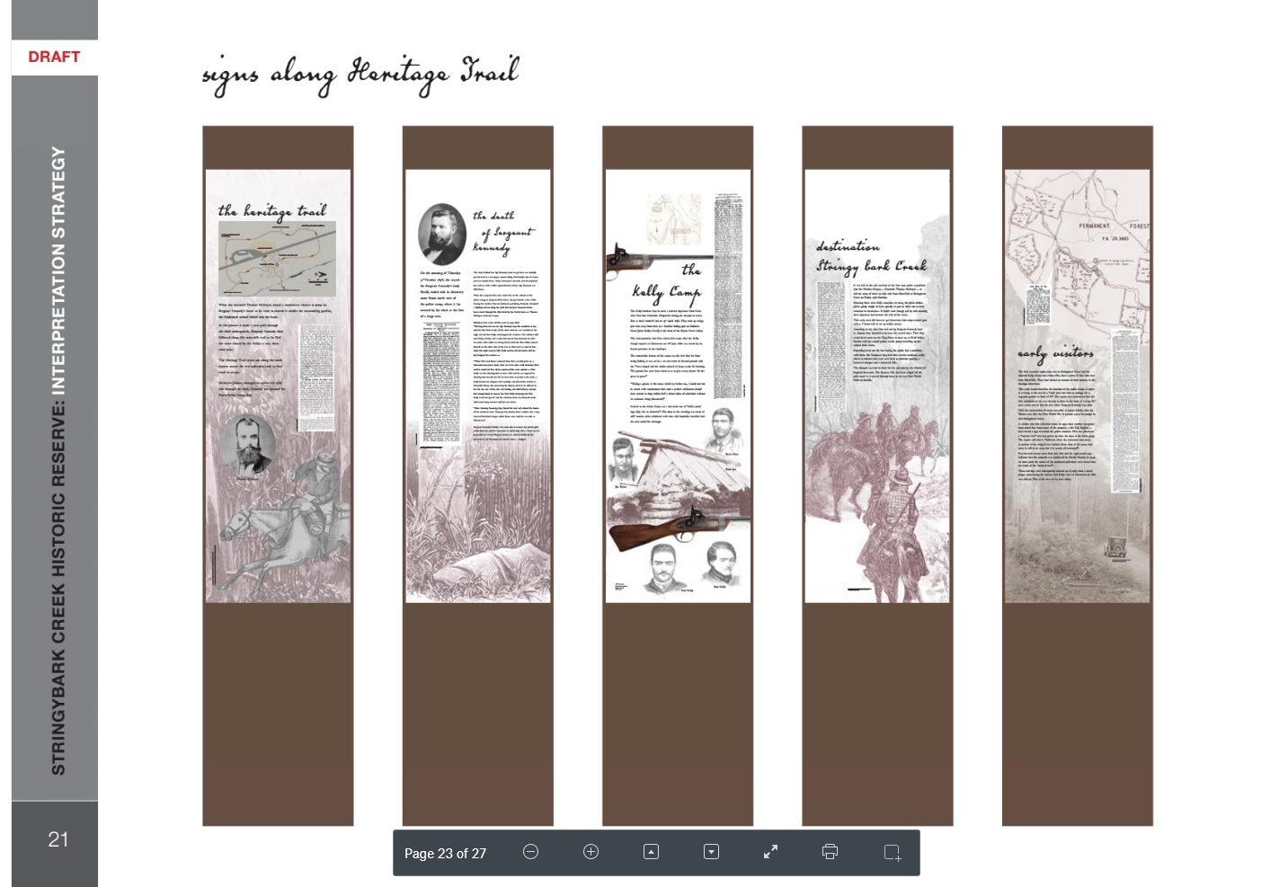
| Comments for 21 | Be aware large
downloads HERITAGE TRAIL SIGNS (81 MB) https://www.dropbox.com/s/asbeih1au0745tx/trail%20signs%20-%20print%20out.pdf?dl=0 |
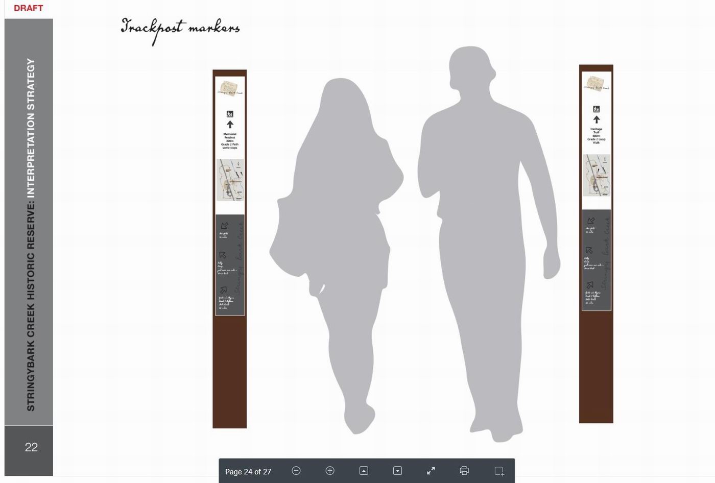
| Comments for 22: | These totem like poles stuck out in the bush are tall skinny structures that are very elegant but where do they lead if none to the actual sites are to be referenced? |
|
Comments Memorial
Plinths
|
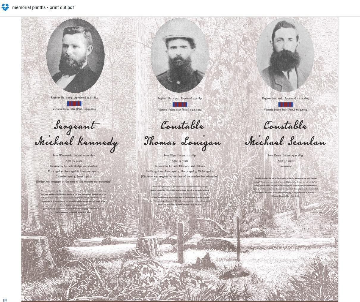
Image above: In this image we see portraits of the three dead
police officers depicted over a very interest drawing that originated
from a photograph that has been totally ignored by this proposal. The
drawing was in the Australasian Sketcher only weeks after the killings and
shows the details of the site where Constable Thomas Lonigan was shot.
Please Take particular note of the slope rising on the right with no creek
between the logs and the rising ground. The creek is to the far left of
this picture. Just behind the stump with the
axe, is a tree behind which is a un-natural structure which is the
remains of a hut fireplace. This actual fireplace was found in Sept
2002. In the foreground centre right are the remains of another hut was stumbling across
in the undergrowth.
This hut site drawn showing two un burnt posts of one side, and some unburnt
vertical members rising up from the ground indicating a wall that
could be described as overlapping shingles. We have to remember this was
drawn as an etching for print in the illustrated news paper, but in the actual photos, the fireplace
behind the log is hardly noticeable. So this means
the artist went to SBC and drew the scene probably with a
copy of the Burman photo in hand, he sketched the best he could to
capture the scenario of the place. He captured the scene perfectly even better than
the photo by photographer Burman. Remember in those days it was not
possible to reproduce photos in print. The fact he drew the fireplace
remains of one obscured hut site, and the un burnt posts of the other,
together with the slope in the background is a three way positive for
where this site is located without any doubt. If this proposal were to have any credibility at all the Burman photo would be the Number one primary source for identifying the actual site of the shootings, YET why is this original photo ignored? In the foreground is a box which in the photo was the photographers photo plate box, so we know the artist had with him a copy of the Burman photo to compare his location to capture a similar view. |
|
Accessing the draft: This email contains the links to where the draft documents are stored in a Dropbox account. The documents are too large to email as attachments. Click on the links and Dropbox will open in your web browser and you can review the documents on the screen. To print the documents, click on the download button (top right) and select direct download. You can then save the documents and open them up as a pdf and print as normal. It is not possible to print directly from the Dropbox. DRAFT STRATEGY (37MB) Several stakeholders contacted me in response to our request for ideas on primary documents to include in the signs. These ideas were passed on to Ian Charles as a starting point for developing the sign narrative and a number have been included or used as reference material. For further information You have been sent this update as someone we understand is interested in the Stringybark Creek project. If you do not wish to receive future updates please outline this via return email. If you are aware of someone that may be interested in updates, please let them know about the project and how to receive further information. Contact Email: Catherine.spencer@delwp.vic.gov.au Phone: (03) 5733 1230
|
| This message board records your messages to
this webpage only for public view. Your message will be incorporated
into this webpage only Click here to send a message to DELWP and tell them what you think about this proposal Free Forums by Bravenet.com |